The Ultimate Guide to Navigating the Seoul Subway (2026 Edition)(EN/JP)
Master Seoul's vast subway system easily. From picking the right card to navigating like a pro, here is your ultimate local transit guide.

日本語ユーザーの方のためにnote.comに日本語でも連載しておきました。 For Japanese users, it has also been serialized in Japanese on note.com.
Content
1. Which Transportation Card is Right for You?
2. Navigating the City (Google Maps vs. Local Apps)
3. Etiquette & Pro-Tips
4. Seoul Subway Line Cheat Sheet
Last update: 16 JAN 2026
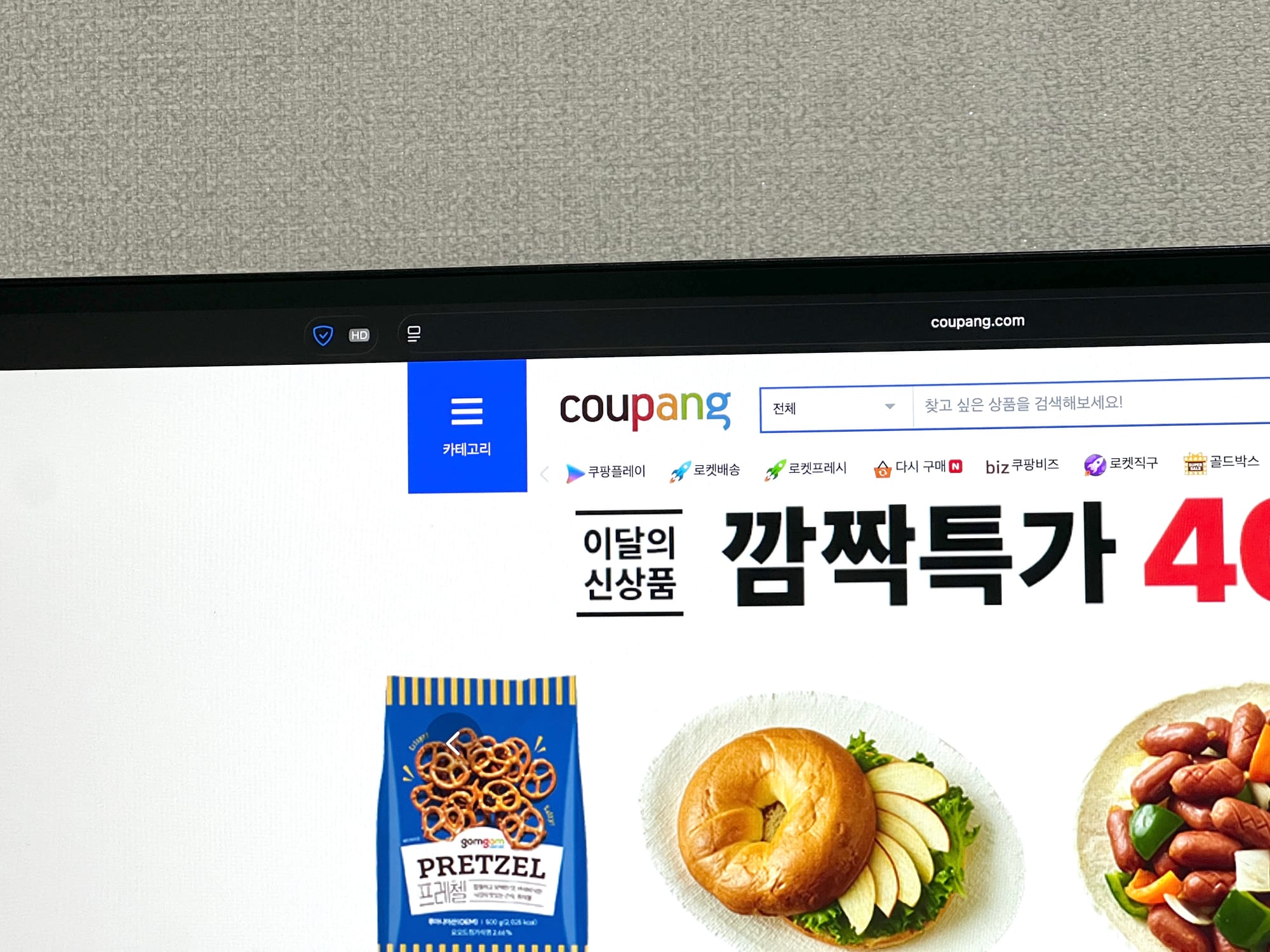
Seoul’s public transportation is widely considered one of the best in the world. For a city covering about 605km2, the density of its subway network is staggering. With 9 major urban lines (Lines 1-9) and 15 additional commuter rails, the system is so efficient that traveling to the suburbs is often faster by subway than by car.
One of the best features is the Transfer System. It’s essentially a social welfare benefit that keeps transit affordable.Unless you're riding private lines like the Shinbundang Line, it's rare to pay more than 2,000 KRW (approx. $1.40) for a single trip.(FYI: This system is relatively young! It started with buses in 2001 and expanded to include subway-to-bus transfers in 2004.)
However, because the network is so well-connected and vast, it can be intimidating—not just for tourists, but even for Koreans living outside Seoul. I’ve written this guide based on my years of experience to help you navigate this concrete labyrinth with ease.
1. Which Transportation Card is Right for You?
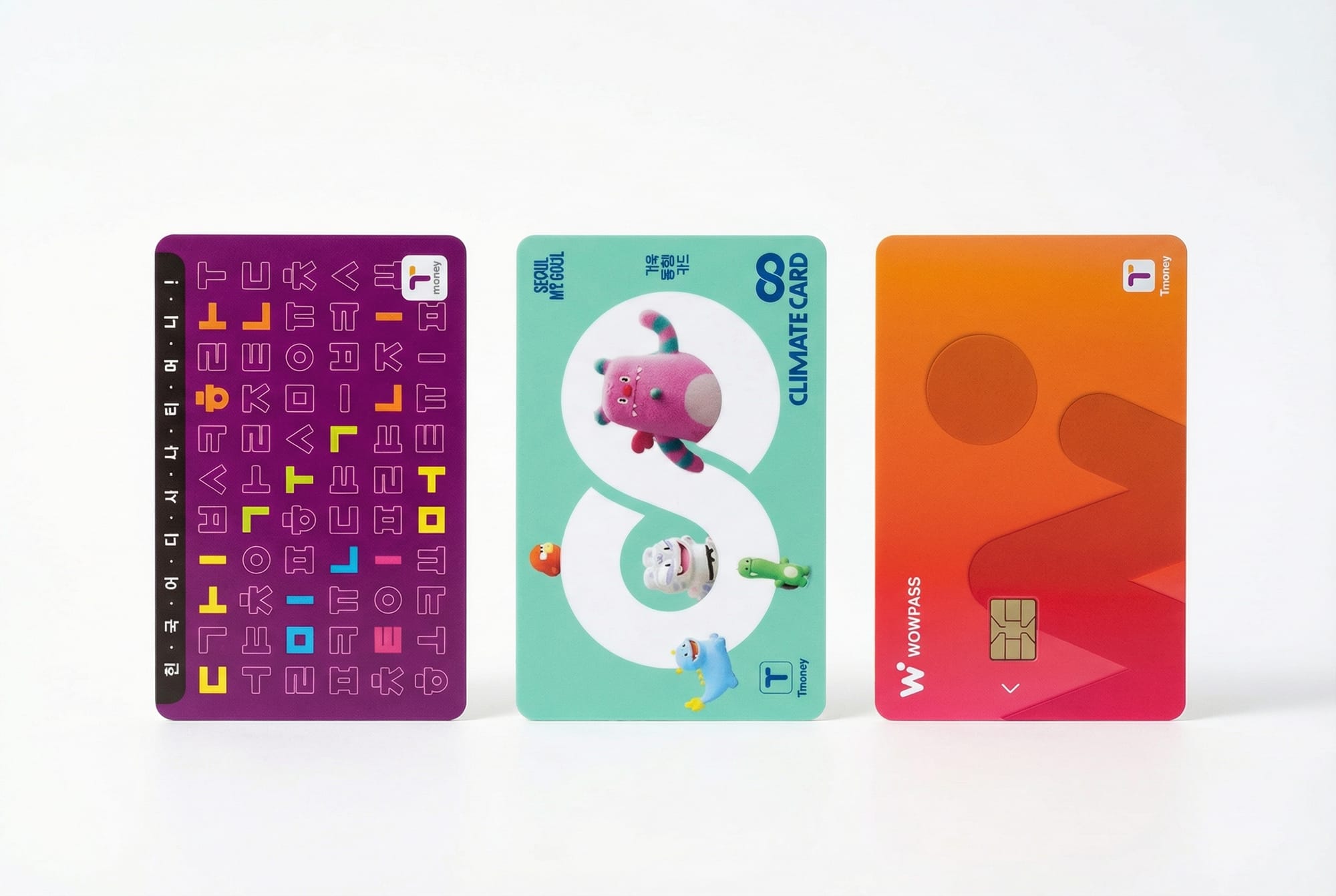
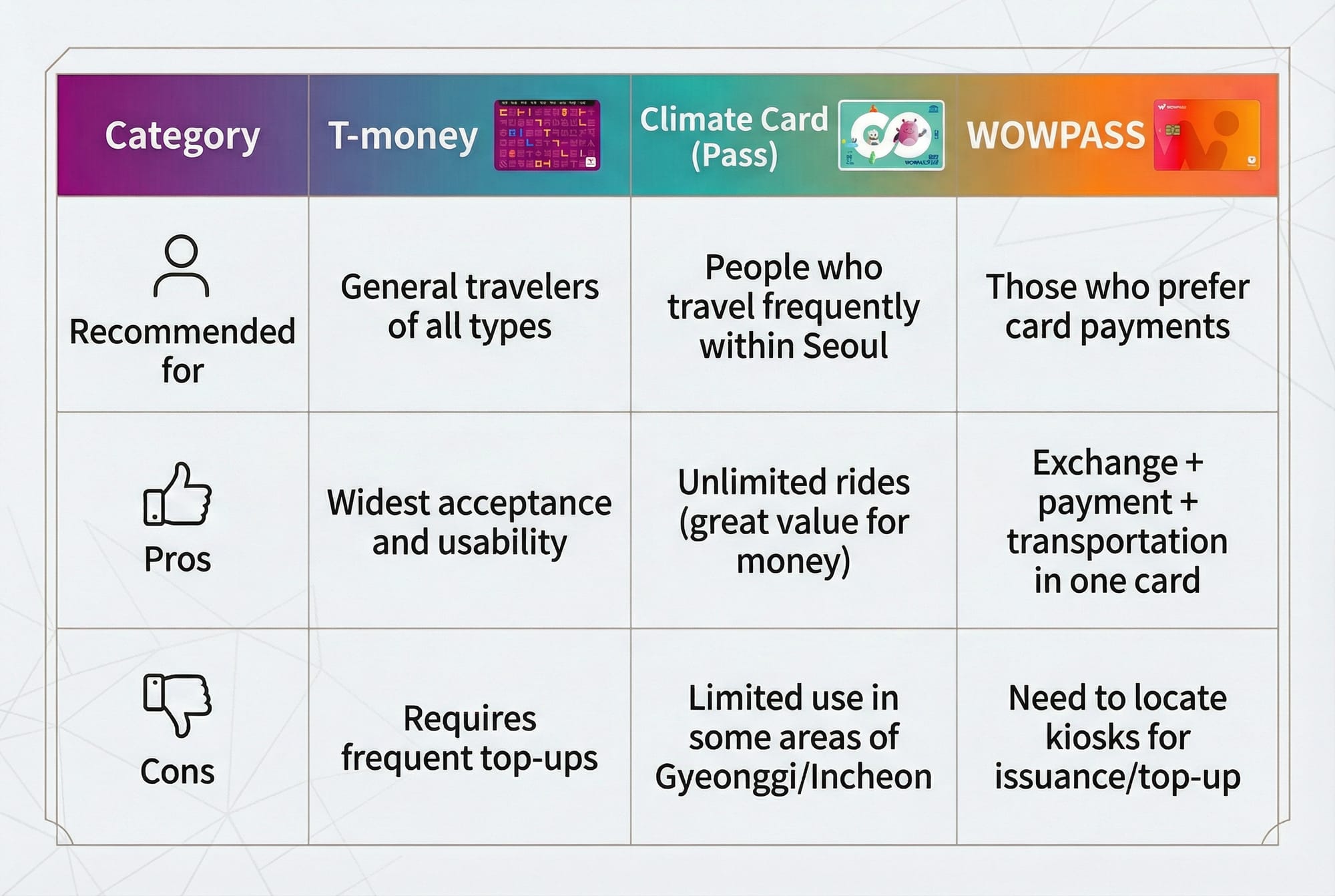
Foreign visitors generally have three great options to choose from: T-money, the Climate Card (Short-term), and WOWPASS.
Note: Cash is rarely accepted on buses. But you need cash when you top-up the T-money card.
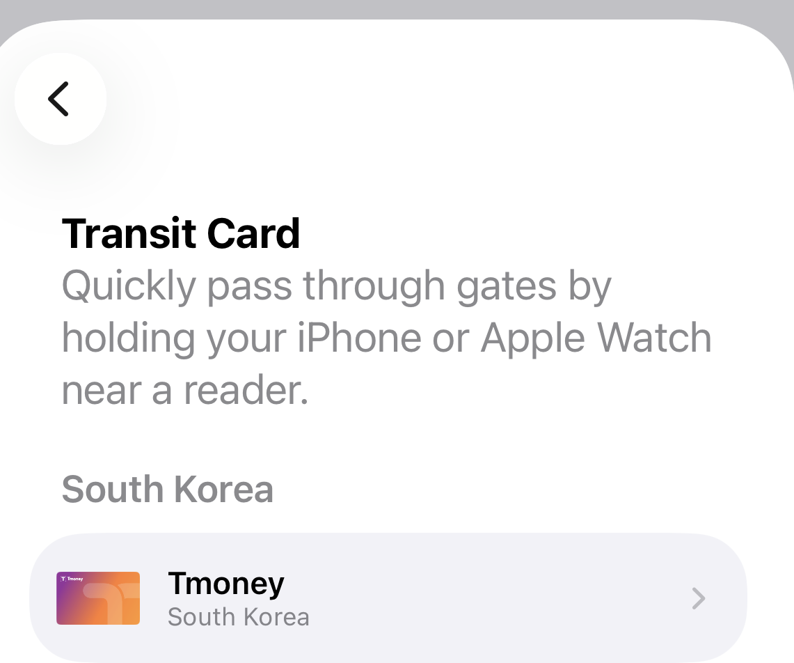
Option A: T-money (The Standard) *(You can use on ApplePay)
- Where to buy: Convenience stores, airports, and subway stations.
- Usage: Subway, buses, and most taxis.
- Best for: General travelers who want a simple, pay-as-you-go card.
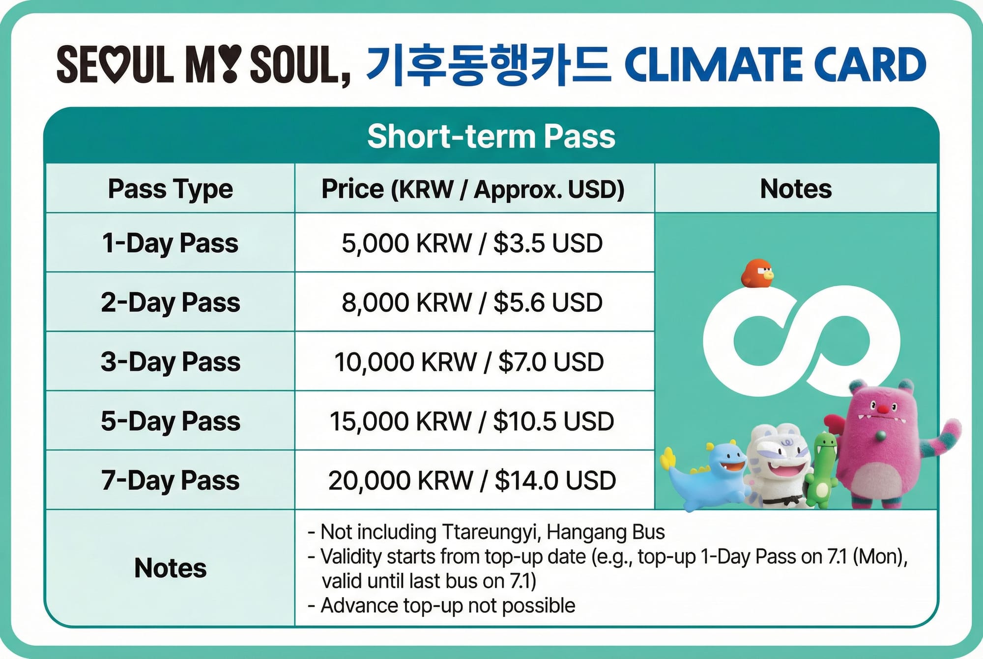
Option B: Climate Card (Unlimited Pass)
Seoul offers an unlimited pass called the Climate Card. It’s a great deal for active tourists.
- Price: 20,000 KRW (approx. $14) for a 7-day pass.
- Value: If a single trip is $1.40, you’ll break even in just 5 days by riding it twice a day.
- ⚠️ Vital Tip: You MUST top up this card with CASH (KRW) at a kiosk. Make sure to have physical bills ready!
- Note: Not recommended if you plan to travel frequently outside Seoul (to Incheon or Gyeonggi-do).
Option C: WOWPASS (The All-in-One)
The WOWPASS is a specialized card for foreigners that combines a T-money card with a prepaid debit card.
- Features: Use it for transit (tap-and-go) and pay at shops/restaurants just like a local credit card.
- Control: Manage everything through a mobile app.
- Convenience: Issue and top up the card at WOWPASS kiosks located in airports and major stations.


Left - NaverMap / Right - KakaoMap
2. Navigating the City (Google Maps vs. Local Apps)
Use Local Maps
Because of national security regulations (due to Korea's unique geopolitical situation as a divided nation), Google Maps and Apple Maps do not update their walking directions or precision data well in Korea. To avoid getting lost, you must use Naver Map or KakaoMap.
Life Hack: How to Find Your Direction
Subway platforms are divided by direction. To ensure you're on the right side:
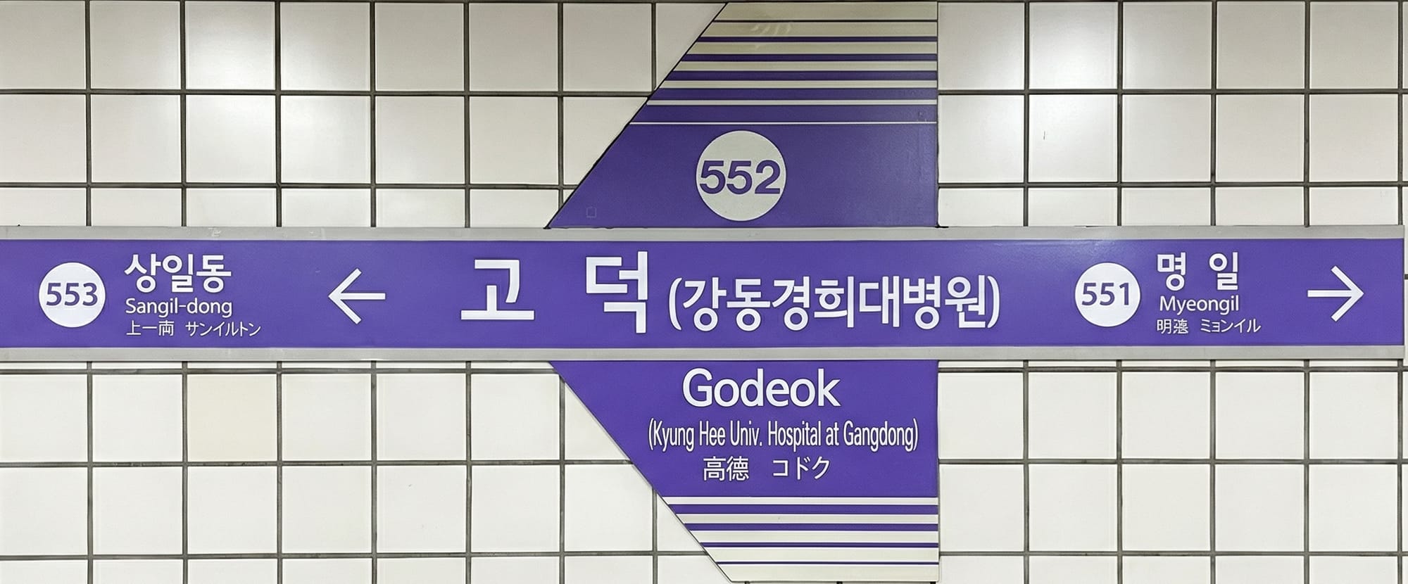
- Check the Final Destination: Look at the signs above the platform. They usually list the final stop of the line. For example, if you're going from Godeok to Gwanghwamun, look for the sign pointing toward Banghwa.
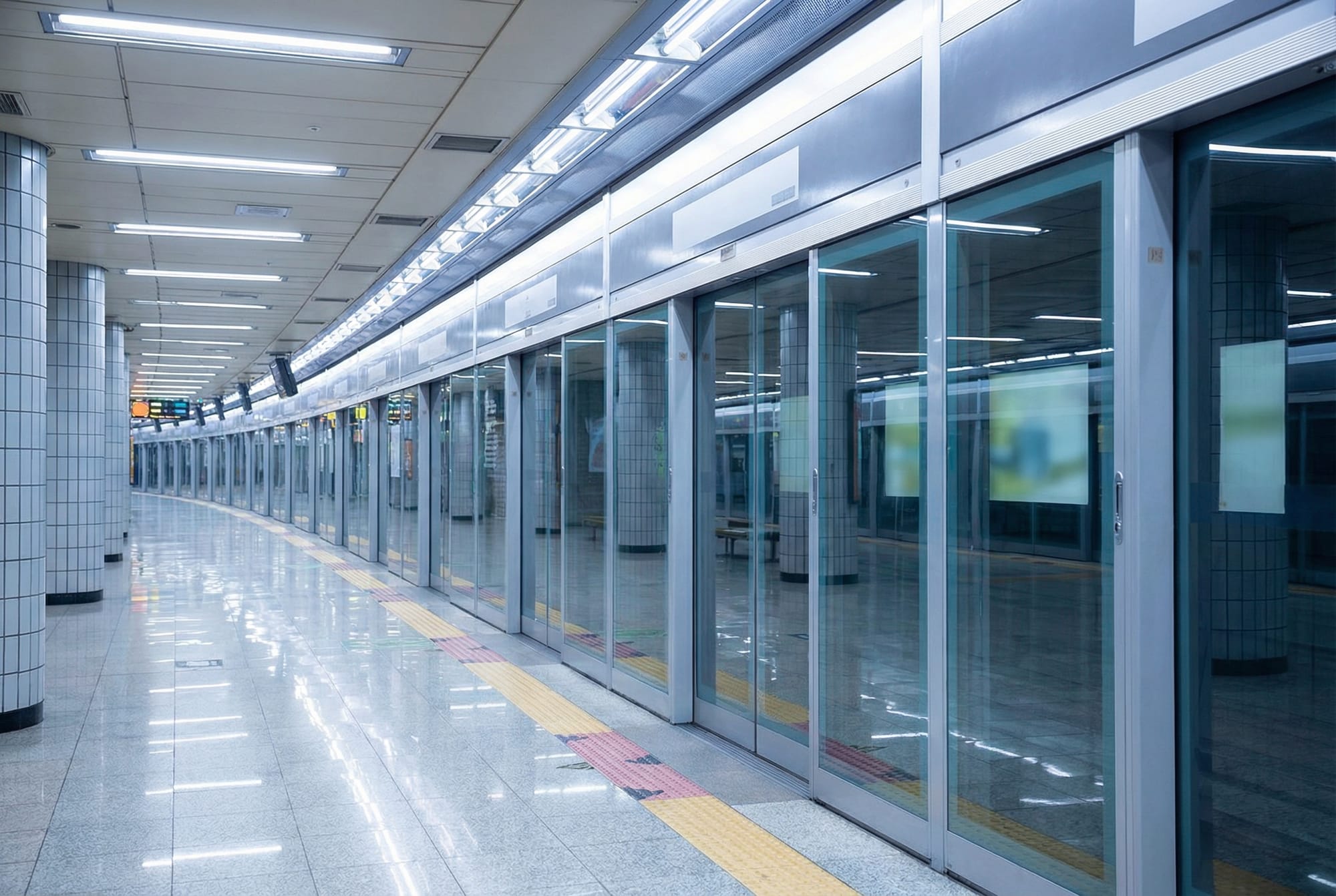
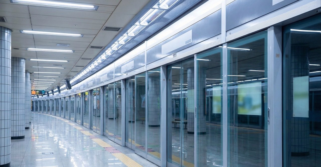
- Check the Previous/Next Station: On the platform walls and screen doors, you'll see the current station name with arrows. If the arrow points to a station that matches your app's "Next Stop," you're on the right side.
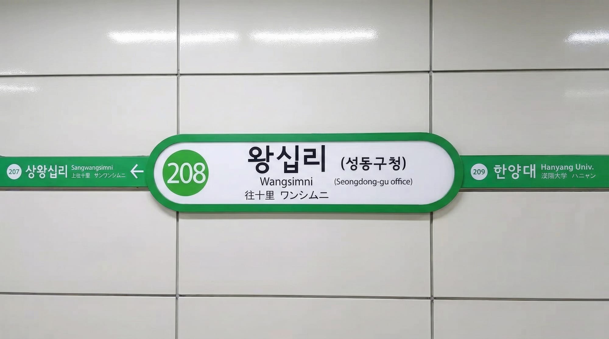
- The Line 2 Special (The Green Circle): Line 2 is a loop, so it doesn't have a "final" destination. It’s best to use the "Previous/Next Station" method here. Check if your intended next stop (e.g., Sangwangsimni) is written in the direction of the arrow on the platform wall.

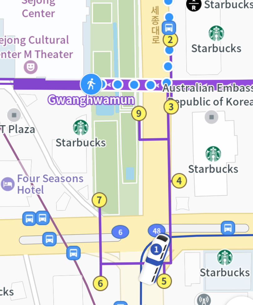
Know Your Exit Number
Seoul's major stations are massive. If you take the wrong exit, you might end up walking 15 minutes just to cross the street. Zoom in on your map app near your destination; look for the yellow circles with numbers. Those are the exit numbers. Follow the signs underground toward that specific number before you head to the surface.
3. Etiquette & Pro-Tips
Avoid the "Sardine" Hours
07:00–09:00 and 17:00–19:00 are peak rush hours. In my experience, Lines 7, 8, and 9 are particularly brutal—you will feel literally "compressed" by the crowd. Unless it's for an urgent business meeting, I personally avoid the subway during these times, and you should too.
Luggage & Elevators
Sadly, older parts of the Seoul Subway were built before accessibility was a priority. While every station has at least one elevator, they are often located in inconvenient spots.
- Pro-Tip: If you see an elevator and have a heavy suitcase, take it. It might be your only chance before a long flight of stairs.
- Escalator Manner: If you use an escalator with a suitcase, never let go of it. Especially when going down, make sure the suitcase is securely on the step before you move.
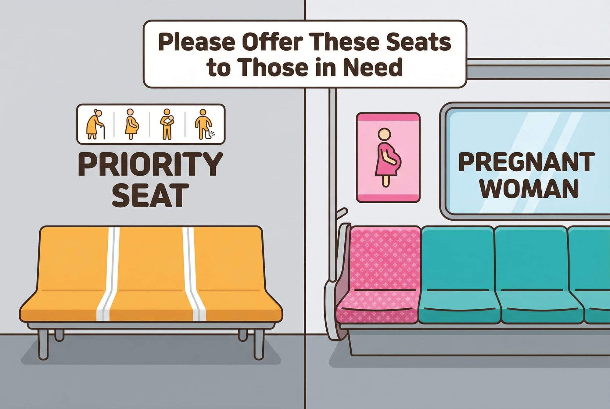
Respect the Priority Seats
At the ends of every car, there are seats priority for the elderly and disabled. There are also pink seats specifically for pregnant women. While you might see some locals sitting there, social etiquette strongly encourages leaving them empty even if the train is crowded.
4. Seoul Subway Line Cheat Sheet
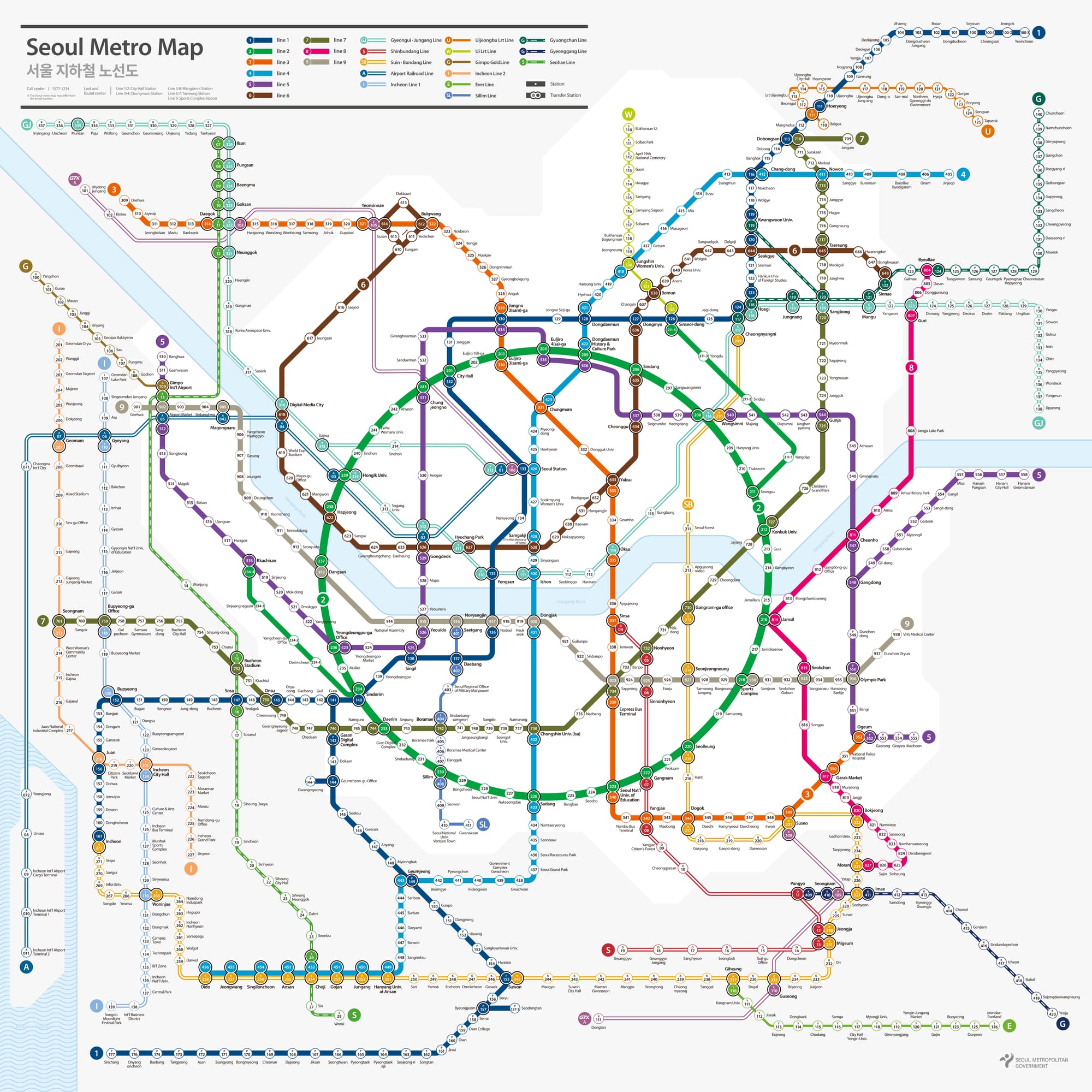
- Line 1 (Dark Blue): A massive line crossing the historic heart of Seoul. Key stops: Seoul Stn., Yongsan, and Jongno(The gateway to palaces and traditional government districts).
- Line 2 (Green): The "Life Line" of Seoul that circles the city. It's always busy because it hits every trendy spot: Gangnam, Jamsil (Lotte Tower), Seongsu (The "Brooklyn" of Seoul), Hongdae, and Sinchon.
- Line 3 (Orange): Crosses from the wealthy south to the historic north. Key stops: Apgujeong (Luxury), Express Bus Terminal, and Gyeongbokgung.
- Line 4 (Light Blue): Great for tourists. Key stops: Myeongdong, Dongdaemun (DDP), and Hyehwa (Theater district).
- Line 5 (Purple): Connects the east and west. Key stops: Gwanghwamun, Yeouido (The "Wall Street" of Seoul), and Gimpo Airport.
- Line 9 (Gold): The only line with a frequent Express Train. It’s the fastest way to travel south of the river but is notoriously crowded. It also charges a slightly higher fare due to private management.
A Note on Buses
Seoul’s bus system is also excellent with dedicated bus lanes. However, during heavy traffic, buses can still get stuck when turning. Also, bus stops are often located on "islands" in the middle of the road, which can be confusing.
In my next post, I’ll explain how to master the Seoul bus islands. Stay tuned!